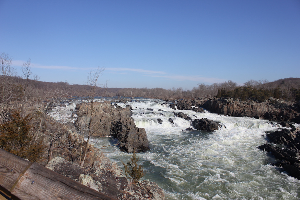
You can find a little bit of everything when you hike Great Falls Park in Virginia — scenic waterfalls and river views, historic George Washington-era ruins, some rocky terrain and some easy flat pathways. Built by a combination of Mother Nature and man, it’s your invitation to come and see what the park has to offer.
You have your choice of over 15 miles of trails to hike. While all park trails are open to dogs on leashes (6-foot leash or shorter), not all trails are necessarily canine friendly. As with all trails, know the trail and your dog’s abilities before setting out on them.
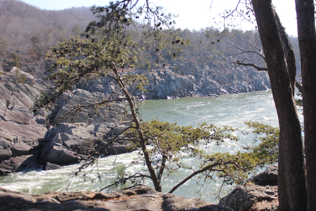
For our hike on this January day, we first took in the views of the impressive Great Falls on the Potomac River and then headed off for a moderate hike on the scenic River Trail, taking advantage of winter’s lack of foliage to experience spectacular views of the Mather Gorge below. Given that the lower portion of the River Trail is rocky and more difficult and that one of my canine companions is 11 years old, we opted to turn off at the Mather Gorge lookout to join up with the Matildaville Trail and then the Patowmack Trail to make a pleasant, canine-friendly circle route that allowed us to take in a little taste of everything — scenery and history.
But let’s start at the beginning of our hike.
Great Falls Overlook Points
Overlook #1

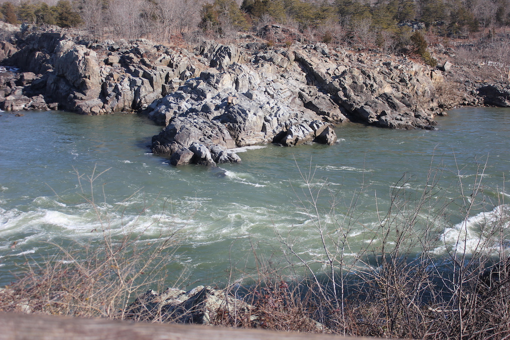
There are three overlook points within a short walking distance (5-10 minutes) from the parking lot and the visitor’s center. Overlook #1 is a little rocky and not wheelchair accessible, but my pups were eager to climb along the rocks so that I could get a close view of the falls. They weren’t too impressed by the view, but they enjoyed the new scents around the rocks.


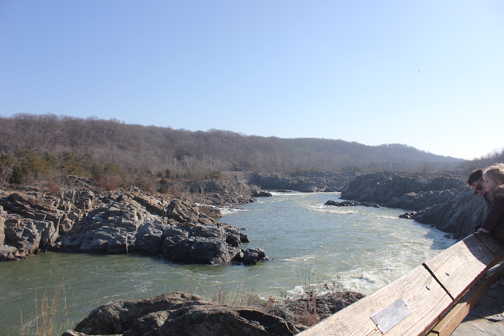
Overlook #2
Overlooks #2 and #3 are accessible by footbridge and stairs/ramp, making them wheelchair and canine-accessible.

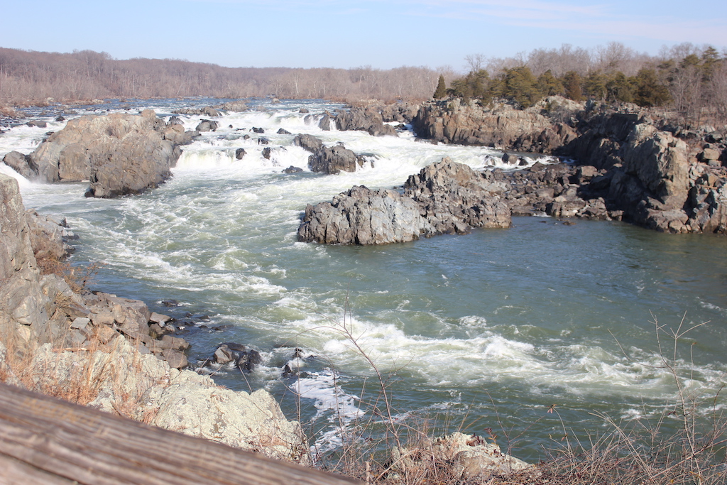
Overlook #3

Potomac Flooding and the High-Water Mark Post
At Outlook #3, we walked from the edge with the Potomac River raging far below over to the “High Water Mark” pole and I looked with astonishment. It’s a little hard to believe that almost 25 years ago to the day — January 21st, 1996 — the river climbed these steep rocky slopes (85 feet in just 48 hours) and rose well above the height of either of my dogs’ heads at this very spot.

At Great Falls, the river drops 76 feet in less than a mile. The banks of the Potomac north of here are 1000 feet wide, but narrow to between 60 and 100 feet in the park as the water passes through Mather Gorge, named after Stephen T. Mather, the first director of the National Park Service. Combine this quick narrowing of the river with storm fronts or unusually fast melting snow, and it can lead to a dangerous rise of the water.
During that particular flood in 1996, water gushed over the falls at 300,000 cubic feet per second, more than 130 times the normal rate. According to the Washington Post at the time, four spectators were rescued by helicopter here at Great Falls. Further up river, the Washington County Fire Department was dispatched to retrieve a kayak, which thankfully turned out not to be a kayak at all but rather… a large stuffed gorilla.

If I had been standing at this very spot in 1972, when Hurricane Agnes swept through, I definitely would have gotten my hat wet (or more likely, I would’ve been swept away), as the top of my head reaches that particular watermark at about 6 feet.
The highest-recorded flood here occurred in 1936, when the Potomac reached more than 17 feet above where we are standing. And six years later in 1942, the next record high was notched. It was World War II and Allied Forces were fighting tyranny abroad, but here at home 800 soldiers and 300 civilians fought a natural enemy – that of the rising waters of the Potomac River. In just six hours, they built a half-mile-long, 6-foot barrier in downtown D.C. to prevent waters from reaching the White House and other buildings.
But alas, my four-legged companions, who are not swimmers or who do not like any form of water other than that in their water bowl, grew anxious for me to move on and give up my fascination for the rising and lowering levels of our local river over the past eight decades. Even more so, Alex, my Lab mix, grew increasingly aggravated that I would not allow him to leave his own mark on the pole. With that we moved on to the River Trail.
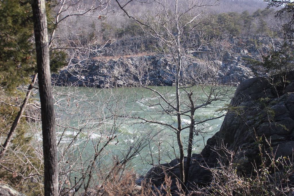
River Trail

Signs easily point you in the right direction to the River Trail from Outlook #3. The trail is a 1.5 mile walk (3 miles round trip) along Mather Gorge that begins at the picnic area and ends at Cow Hoof Rock.
While the first portion is not particularly difficult, it follows the rocky edge of the gorge and has rock outcroppings and some downed trees that can be obstacles to elderly dogs or those that are height challenged.

The trail is well marked by blue blazes and you will experience beautiful views of the river and gorge below, with cliff heights ranging from 25 to 75 feet.

Once we reached the Mather Gorge plaque, honoring the late Stephen Mather, we followed the signs toward the Matildaville and Patowmack Canal Trails. These were not only easier on the pup’s paws, but they also provided a loop pathway so that we would not have to retrace our steps back to the visitor’s center.


The Patowmack Canal and Matildaville
Once we left Mother Nature’s handiwork along the scenic river, we entered the historic portion of our journey — the remnants of the manmade Patowmack Canal system and Matildaville.
Following the Revolutionary War, George Washington had a vision to boost trade by connecting the East Coast with the Ohio River Valley with a canal system that would connect the Ohio River to the Potomac River. The canal system would need to circumnavigate five sets of waterfalls, with Great Falls being the largest series.

The Patowmack Company was established in May 1785 and laborers (mostly slaves and indentured servants) worked on the canal for 17 years. A small settlement, which was chartered in 1790, was established for these laborers and canal workers. Three years later, Henry Lee, father of Robert E. Lee, took out a 900-year lease on the newly established charter town and named it Matildaville after his late wife, Matilda Ludwell Lee.
Matildaville flourished, but was dependent on the success of the canal. While the portion of the canal that skirted Great Falls was dubbed the greatest American engineering feat of its time, unfortunately circumnavigating the five sections of falls and having to dredge portions of the river was costly. The Patowmack Company spent $650,000 to build the canal system, but had only taken in $172,000 in tolls. The system faced other problems too, such as canals drying up during the summer, freezing over during winter, and flooding during rainy months which made passage dangerous.

The Chesapeake & Ohio Company took over operations of the Patowmack Canal in 1828 and utilized the canal system until 1830, when it shifted over to their newly cut canal system on the Maryland side.
With the closure of the Patowmack Company workers started to leave Matildaville, although the town received a new breath of life when the Great Falls Manufacturing Company established a water-powered textile factory in the mid 1830s. The town, renamed South Lowell, prospered until 1858 when a lawsuit over water rights ensued a 40-year legal battle that ultimately was the end of the town.

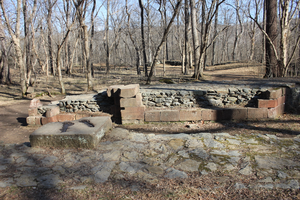
So what you see as you hike the Patowmack Canal Trail and the Matildaville Trail are remnants of the canal system and the town.
Matildaville Trail, Patowmack Canal Trail, and George Washington’s Foxhounds
The Matildaville Trail is a 1.1 mile trail (although we did not hike all of it today) that is fairly level until it nears the southern end of the park. You will see ruins from the town of Matildaville, as well as those from the Patowmack Canal locks. (To preserve these ruins, please do not climb on them.) The Patowmack Canal Trail is an easy, one-way, 1.25-mile trail that follows the remains of the canal system. Pick up a map at the visitor’s center or download one here to plan a circular route that allows you to take in views of the river and ruins from the canal and town.

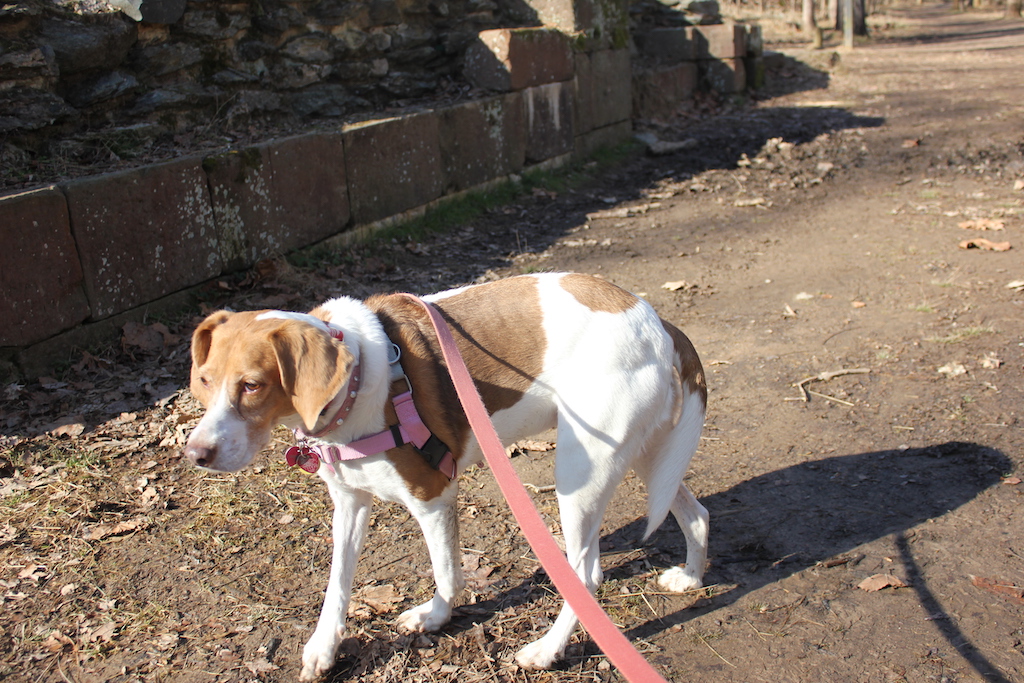
While walking along the Patowmack Canal Trail, I decided to regale my Foxhound, Penny, about her ancestry. You see, not only is George Washington known as one of the founding fathers of our country, but he is also considered the founding father of what is now known as the American Foxhound. As a breeder and avid fox hunter, Washington kept dozens of dogs at Mount Vernon and was trying to breed specific traits in his English Foxhounds to get a hound that was faster and could cover more ground.
Washington received a gift of seven Grand Bleu de Gascogne hounds (a.k.a. Normandy Hounds) — an ancient French breed dating back to the Middle Ages — from his friend Marquis de Lafayette, the French general who commanded American troops during the Revolutionary War. According to the American Kennel Club, Washington perfected the breeding between his English Hounds and the Normandy Hounds to create what is now the American Foxhound.
It is said that all American Foxhounds are descendants of Washington’s hounds. So I told Penny about her Great, great, great great… Grandmother “Sweet Lips,” one of Washington’s prized hounds. (Washington had loving names for his female dogs, like Sweet Lips, Venus and Truelove. However, his male dogs had names like Taster, Tippler and Drunkard.) I marveled at the thought of Penny and me walking the very same trail that Washington walked with Sweet Lips by his side.
Penny’s ears perked at what I presumed was interest in her lineage, but alas I followed her gaze. Instead her attention was peaked by a dear deer friend that she found crossing the Patowmack Trail.
And that’s where this trail tale ends.

About This Hike:
Distance: The River Trail is 1.5 miles one way; Patowmack Canal Trail is 1.25 miles one way; and Matildaville Trail is 1.1 miles one way. For a full description of all park trails and to download a printable map, please click here.
Difficulty of today’s hike: Moderate (River Trail) to easy (Matildaville and Patowmack Canal trails).
Trailhead: 9200 Old Dominion Dr., McLean, VA 22102. For Great Falls Park website, click here.
Admission: $20 per vehicle for a 7 day pass. You can purchase an annual pass for $35 that allows for unlimited visits to both the Great Falls Park in Virginia and C&O National Historical Park in Maryland for a year. An annual U.S. National Parks Pass – America the Beautiful Pass – is available for $80, which provides access to all National Parks and Forests nationwide (senior and military passes also available).
Facilities: Picnic area and public restrooms are available at the visitor’s center.
Notable: Breathtaking views of Great Falls and Mather Gorge. Walk through remnants of canals and locks from the Patowmack Canal System and the ruins of Matildaville. Swimming and wading in the river is prohibited.

0 Comments